We have had frequent, long-lasting eddy patterns in the greater San Francisco Bay Area.
Today, June 15 one of the longest eddy patterns continues, with southerly coast winds the most reliable Bay winds north of the Bay Bridge.
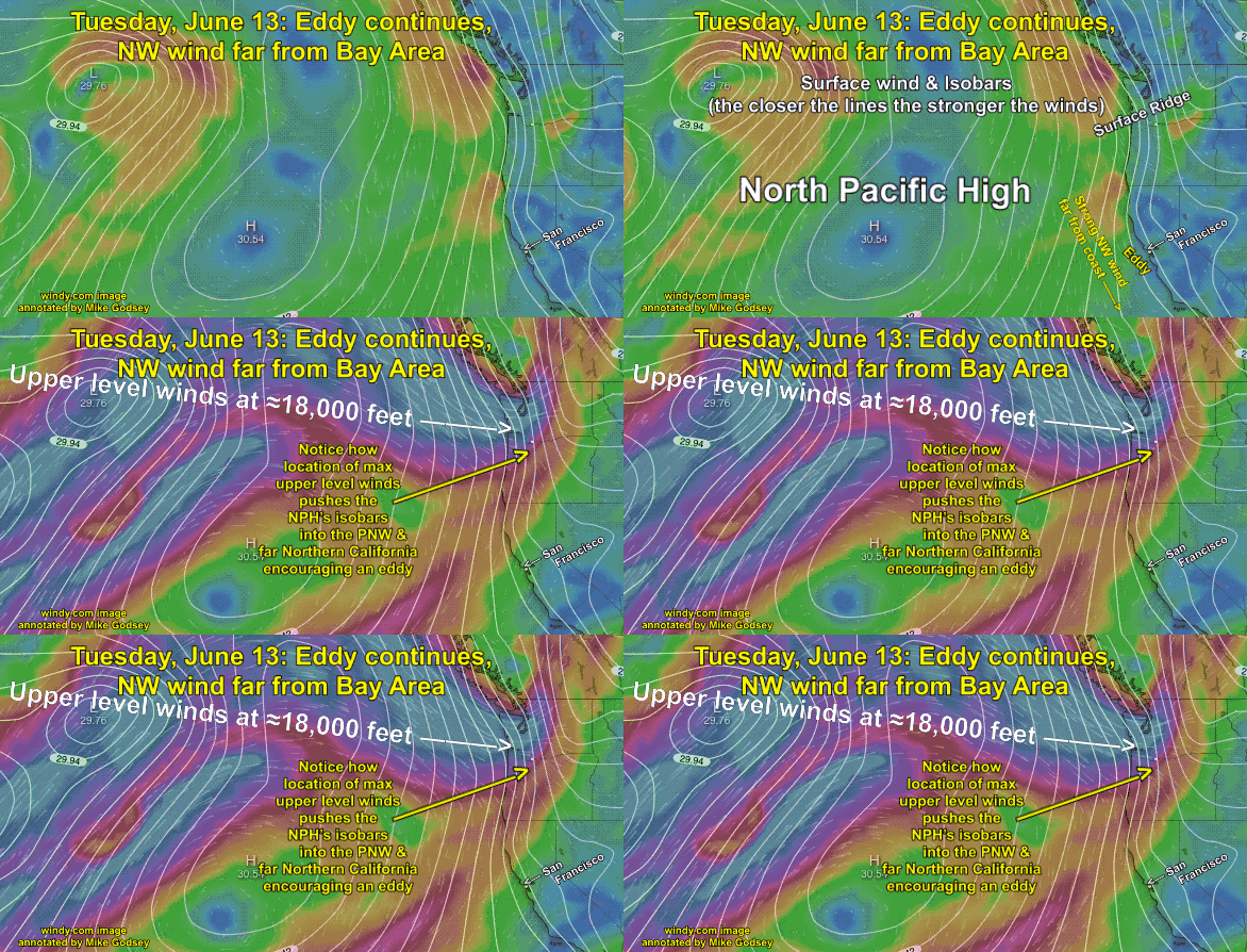
In this first image from June 13 notice how the NPH has shoved a ridge into the Pacific Northwest. This is represented by the white isobar lines. Notice how the upper level winds converge in this area tightening the pressure gradient in this area. This ridge produces NNE winds aloft and encourages low pressure to balloon over the coast north of the Golden Gate. These factors have been persisting keeping an eddy in our area.
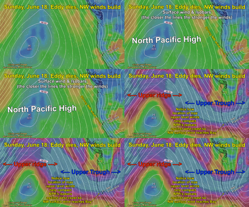
I expect the current eddy pattern to begin to end midday on June 17 and then abruptly die on June 18. At that point, the North Pacific High’s surface NW winds begin to build.
The second image shows the North Pacific High tightening isobars along our coast and the upper level winds that encoureage this building NW winds.
But the real focus of this blog is HOW the upper level winds lead to the eddy, its death and the developoment of strong NW ocean winds on the San Francisco coast.
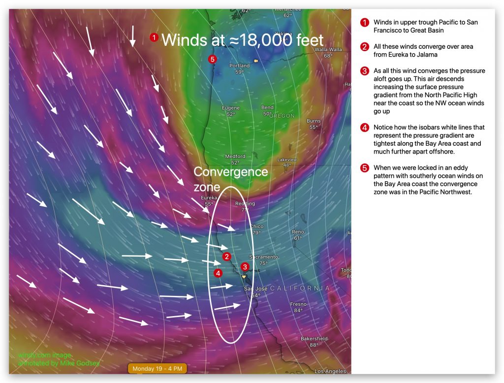
Notice the southward loop in the upper-level winds at ≈18,000 feet. This loop is known as an upper trough and represents cooler air moving southward. Notice how these winds converge as they approach the Northern California coast. Packing all this air into a smaller volume makes it denser so it subsides towards the surface. This does 2 things. One it increases the surface pressure. You can see this by looking at the isobars of the North Pacific High notice how close together they are near the San Francisco Bay Area coast line. The tighter the isobars the stronger the pressure gradient and the stronger the NW ocean winds. Secondly the wind in the convergence zone at ≈18,000 feet is moving very fast. As this air subsides it carries that high velocity wind closer to the surface. So I expect gusty strong wind Sunday and Monday.
Forecasting this far in advance is always sketchy so put all this in your calendar and lets see how it plays out.
The post West Coast Wind Blog: San Francisco Eddy dies June 18 and strong NW winds build. Why? appeared first on Blog.WeatherFlow.com.


