Notifications
ALL BUSINESS
COMIDA
DIRECTORIES
ENTERTAINMENT
FINER THINGS
HEALTH
MARKETPLACE
MEMBER's ONLY
MONEY MATTER$
MOTIVATIONAL
NEWS & WEATHER
TECHNOLOGIA
TV NETWORKS
VIDEOS
VOTE USA 2026/2028
INVESTOR RELATIONS
COMING 2026 / 2027
ALL BUSINESS
COMIDA
DIRECTORIES
ENTERTAINMENT
FINER THINGS
HEALTH
MARKETPLACE
MEMBER's ONLY
MONEY MATTER$
MOTIVATIONAL
NEWS & WEATHER
TECHNOLOGIA
TV NETWORKS
VIDEOS
VOTE USA 2026/2028
INVESTOR RELATIONS
COMING 2026 / 2027
About Me
 Latinos Media
 Latinos Media provides all types of news feeds on a daily basis to our Members
Posted by - Latinos Media -
on - July 20, 2023 -
Filed in - Weather -
-
1.3K Views - 0 Comments - 0 Likes - 0 Reviews
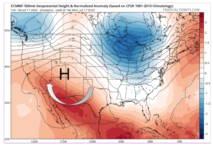

A relentless ridge of High pressure is dominating the weather for the Western US. This is not an atypical pattern for mid-July but the strength of the ridge and its persistence has broken some temperature records. This pattern doesn’t just signal the start of the summer heat but also the beginning of the monsoon season for the deserts.
The flow around the base of the High draws moisture-laden air into the area. That moisture interacts with the heat at the surface in the deserts and that propels the air quickly upward, building large thunderstorms. The satellite (above) showed a complex of thunderstorms that built explosively and then pushed toward the Phoenix metro area on Monday.
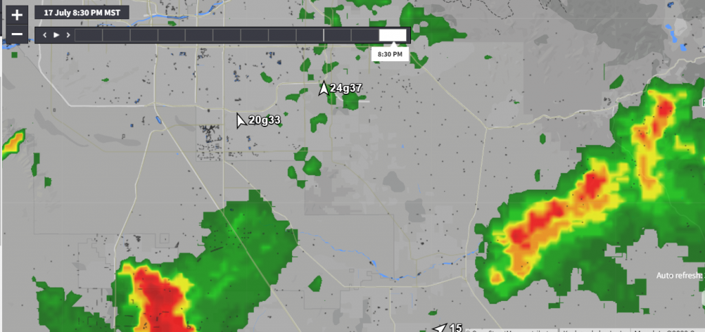
Arizonans watch for the return of these thunderstorms to bring rain and some cooling. These storms form each summer as the monsoonal winds develop with these persistent Highs. The heavy rainfalls are essential to support farms in the region. But along with the rain comes strong winds that are termed haboobs. As the raindrops travel through the cloud they drag the cool air from the top of the cloud down to the ground. This helps to mix the air and cool the ground. But the larger the thunderstorms the higher these winds can be. Monday’s storms produced wind gusts in excess of 50 mph.
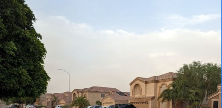
Those winds can bring heat relief but that cooling comes at a price. The winds pick up the desert sand and can form thick dust clouds that push out ahead of the thunderstorms. You can see above the view from Mesa on Monday as the dust cloud approaches ahead of the thunderstorm complex. Visibilities can lower very quickly as the gust front approaches.
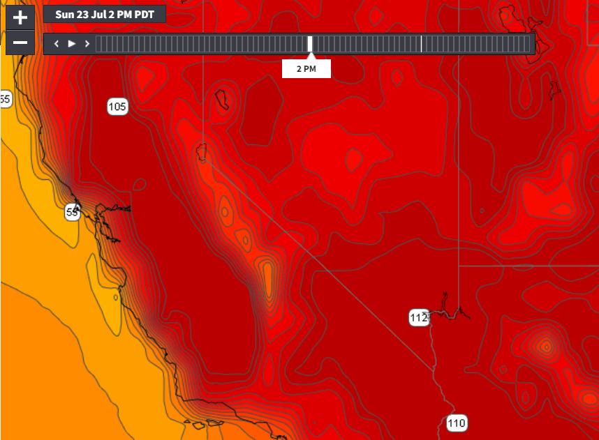
The High will be hanging around for the foreseeable future. The long-range models show the High expanding its influence and pushing back westward. That means another peak in the temperatures this weekend, with 100-degree heat approaching the coast. So far the coastlines stay under the influence of marine clouds as large eddies develop. This will keep the beaches cool and sea breezes blowing.
The post Summertime High Pressure and Monsoons Return. appeared first on Blog.WeatherFlow.com.