ALL forecasts herein are the result of my analysis, (to which you will see me at times, insert excerpts from various agencies due to the nature of the importance of the information) and I am solely responsible for the content. As ALWAYS, follow the National Hurricane Center, National Weather Service, and your local Emergency Management officials for emergency decisions. In addition, this is strictly a FORECAST OFFICE. I CANNOT make decisions regarding travel plans, etc. My purpose, is to provide you the information, based solely on information I analyze, and the accuracy of the information at hand of the time of analysis, so you may make informed decisions.
(T. F. “Storm” Walsh)
For those who have donated to my site, your help has been greatly appreciated. If you are not aware, donations to my site help pay for subscriptions to sites I use as well as software updates, which provide all the models and information used in my forecasts. To donate, please click the DONATE button to the right side of the page, or on the graphic of the dog. Any help you provide is immensely appreciated!
DONATIONS ACCEPTED AND APPRECIATED


If any of my subscribers here are on Facebook, and are in any of the weather groups I posted in, please let everyone know that Facebook suspended my old account. Since I may not be able to access Facebook anymore, you may follow me on twitter. The twitter button on the left of the page does not work. Please follow me here: https://twitter.com/Michael1227910
If you wish to become an email client and receive my forecasts by email, please send me an email at the email address at the bottom of the page…subject: EMAIL CLIENT.
I will reiterate, my forecasts are based on the available information at the time of analysis, and are only as accurate as the information analyzed and the solutions provided. Keep in mind, if a forecast doesn’t exactly pan out, remember, the atmosphere is fluid in motion. When models are being analyzed, that’s just one run, and I have to go with what is presented. After that, models don’t update again for another 4 – 6 hours, so, what happens between that time is unknown, and forecast conditions can change slightly, to greatly. This will have an effect on my actual forecast. Unless otherwise noted, satellite imagery is provided through Weathernerds.org
Greetings everyone!
This post is shorter than usual, as my flash drive sustained damage, and the current one is full. I’ll try to have a more thorough update the remainder of the week. This update is just to give a “basic” heads up of what’s to come. Each system will be addressed on it’s own in subsequent posts if time allows.
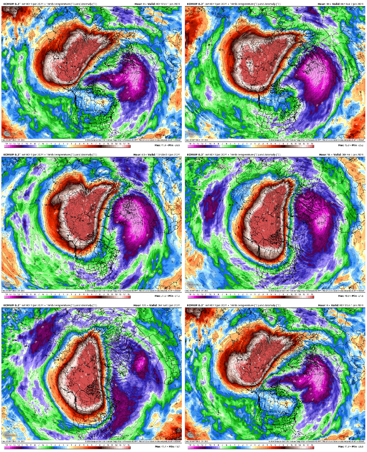
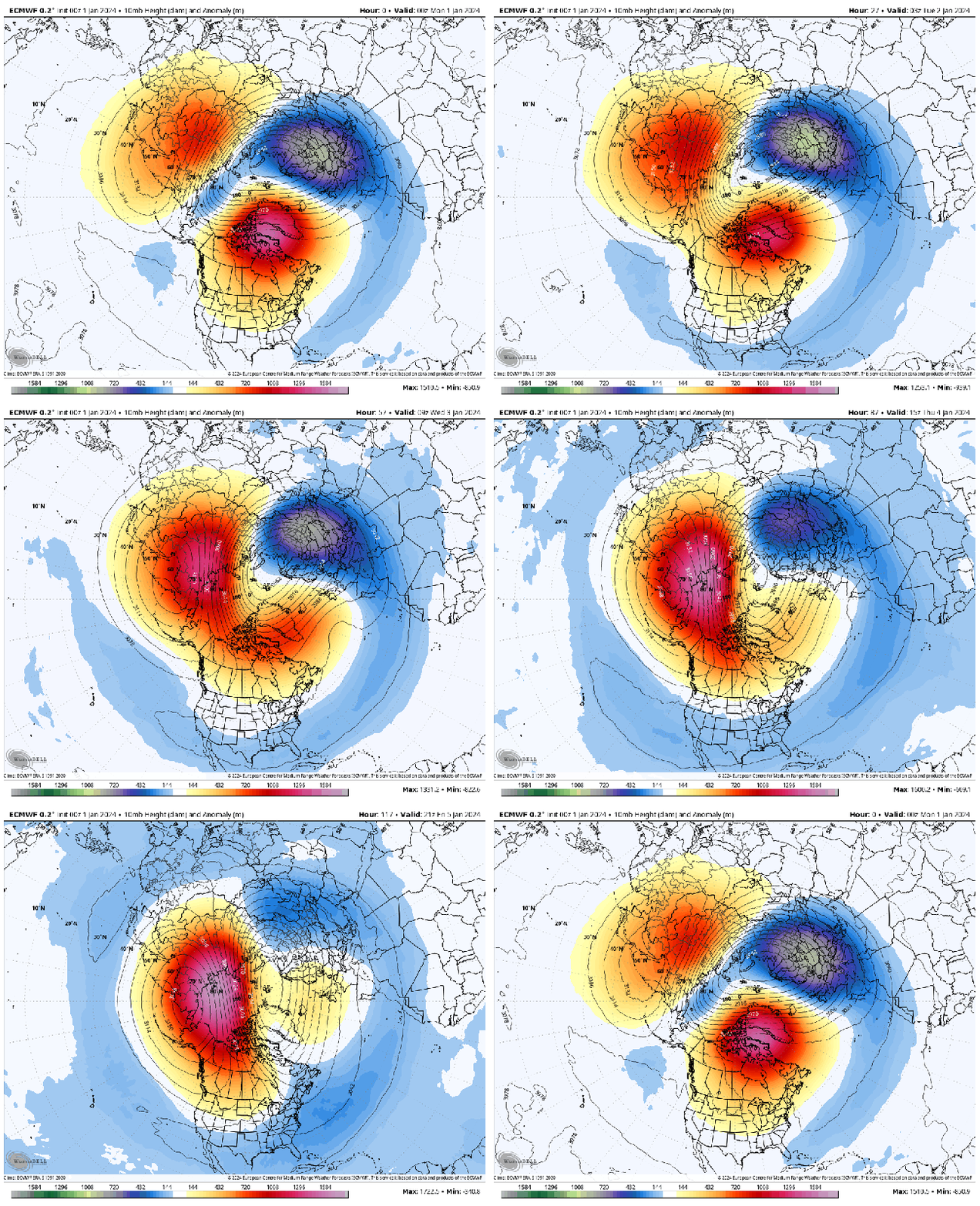
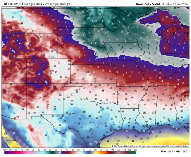
Analysis of models this morning indicated a reload for another SSW this week. Right now, it doesn’t appear that a reversal of the winds at 10 mb will occur, or if the Polar Vortex may split, however minimum temperatures are forecast to remain very cold over the northern 1/3 of the country. However by mid month, the GFS is suggesting that some Arctic air may intrude over the Dakotas, Minnesota, areas.
10 MB TEMPERATURE ANOMALY FORECAST
10 MB HEIGHT ANOMALY FORECAST
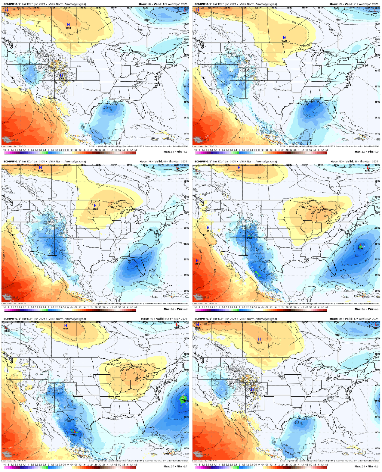
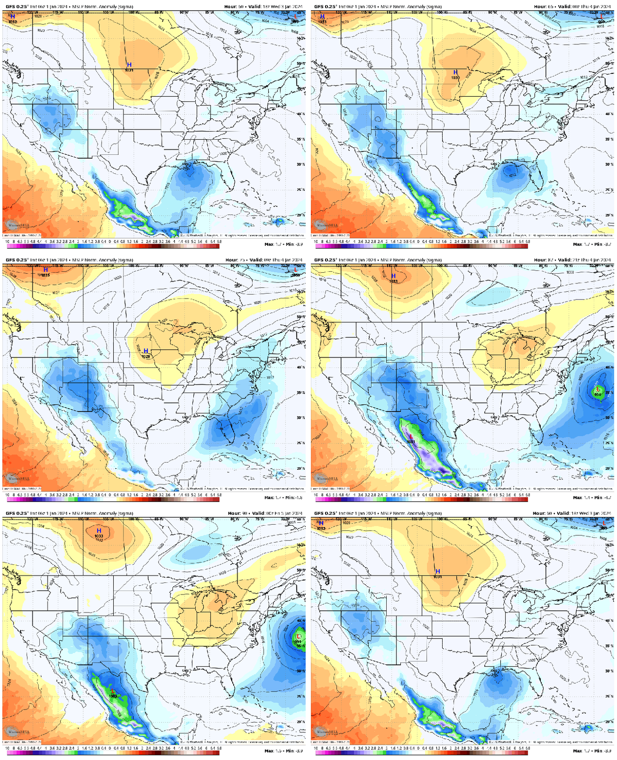
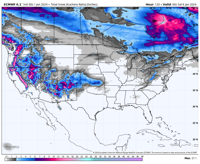
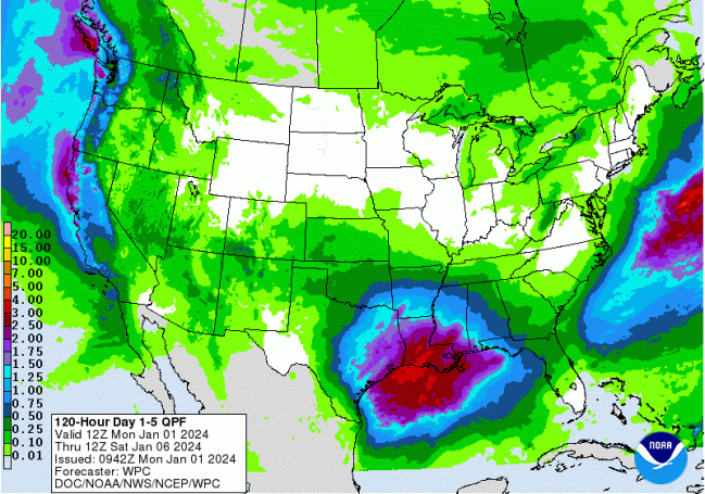
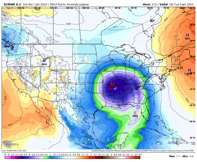
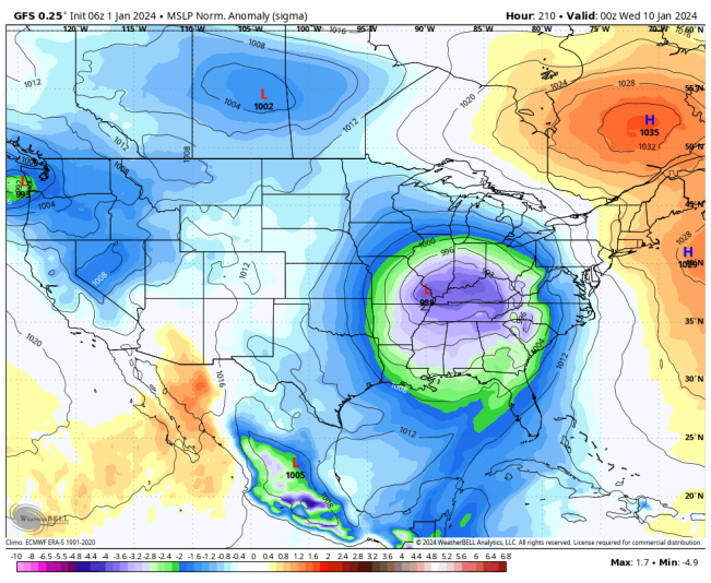
A short series of at least 2 Miller “A” systems is forecast, with the first developing along the Gulf Coast near LA., then moving toward the U.S. east coast offshore, becoming Nor’easter. The first begins to take shape on the 3rd, and the other on the 6th. These do not appear to bring much in the way of snow over the central and eastern portions of the U.S. However, around the 9th – 10th, models are projecting a more powerful and large storm system which originates near the same area, but moves northward, affecting portions of the south central and Great Lakes regions. I will be addressing this system more likely in my Jan. 08 update. Models suggest this system may bring much heavier snowfall and totals for the Ohio Valley, northward and east. The following animations are for the 1st Nor’easter from the ECMWF and GFS models:
ECMWF 5 DAY SNOWFALL TOTAL
WPC 5 DAY PRECIPITATION FORECAST
ECMWF AND GFS MSLP ANOMALIES 8 DAY FORECAST
GFS 14 DAY MINIMUM TEMPERATURE FORECAST
 SSW AND POLAR VORTEX ARTICLES FROM WIKIPEDIA
https://en.wikipedia.org/wiki/Sudden_stratospheric_warming
https://en.wikipedia.org/wiki/Polar_vortex
The following NWS Watch / Warning map will provide local NWS information for your area. Click the image, then once it refreshes, click on your area of interest to view any special weather statements, hazards or advisories for your area.
NWS WATCH / WARNING DISPLAY (LINKED…CLICK MAP, THEN YOUR AREA)

NWS DOPPLER RADAR LOOP (LINKED, CLICK RADAR MAP)


 SSW AND POLAR VORTEX ARTICLES FROM WIKIPEDIA

