The weather warms up for tomorrow but the wind gets going too, and this does include parts of the Denver metro area.
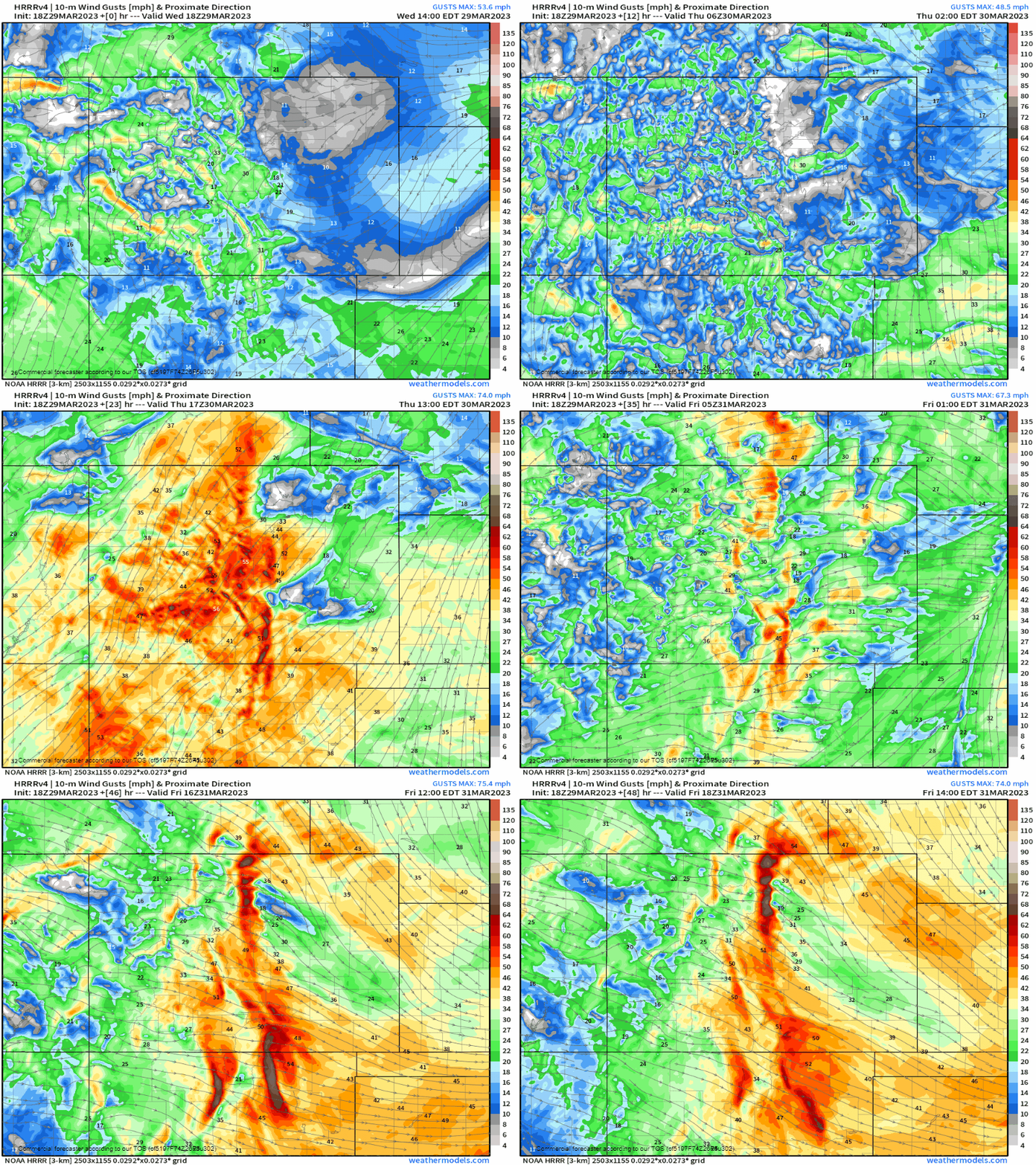
Sometimes we can't have one without the other, and when it comes to the warm-up Thursday we will have some impactful wind, too; especially for the high country and across Southern Colorado. The impact? Dust, pollution, fire danger and blowing snow due to the wind we are expecting.
This animation will grab your attention - it's the wind gusts ramping up for the next couple of days.

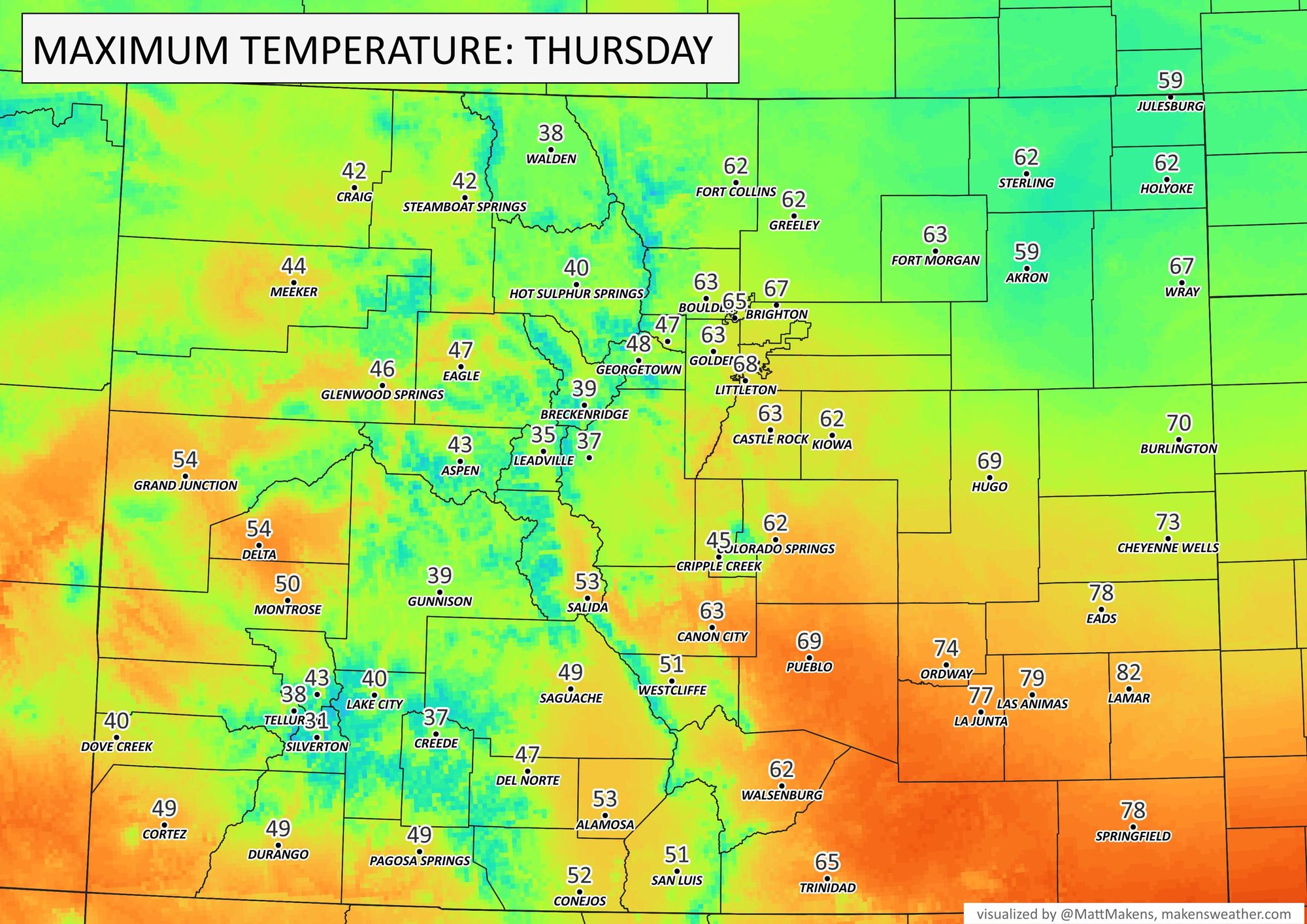
At the same time, temperatures will be warming up.
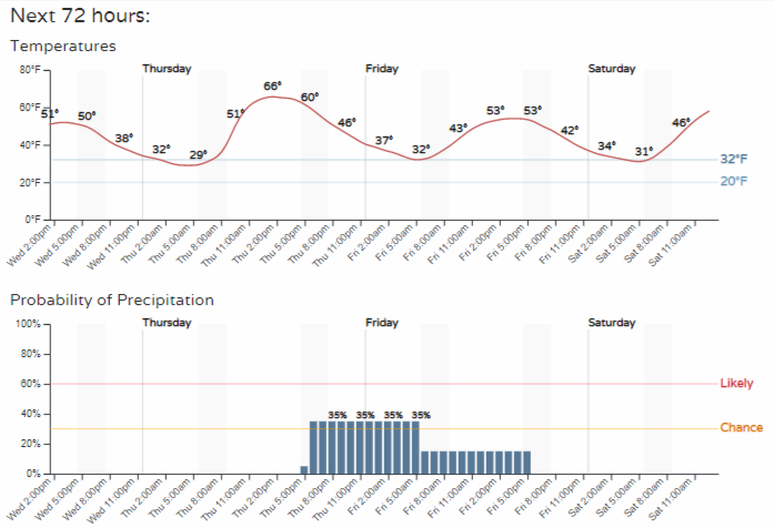
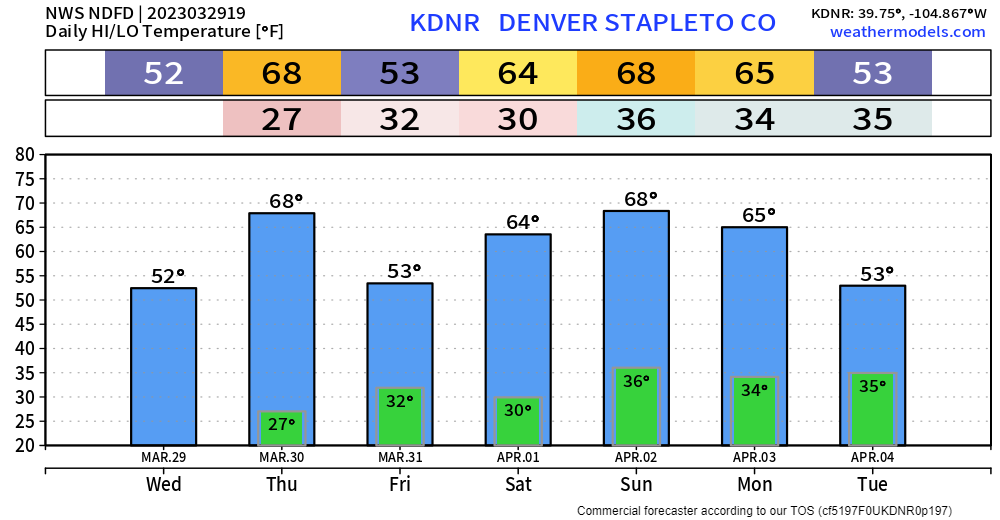
For Thursday, Denver will come near to 70°. For those from Fort Collins stretched eastward across the Plains temperatures will stay cooler due to the snow that remains on the ground - much like the past few days, but with decreasing snow you'll have a warm-up as well.
Noon temps across NE Colorado showing quite a contrast. 40s around Denver, 50s in the Springs, 30s in FOCO (snowcover), and 20s in far NE Colorado with snowpack plus cloud cover. Data via MesoWest. #cowx @weather5280 @MattMakens @BianchiWeather @CReppWx #notspringeverywhere pic.twitter.com/wpALqMxRqB
— Howard Gebhart (@GebhartHoward) March 29, 2023
It'll be a bit optimistic for Northern Colorado to hit the 60s, but we'll make a run at it. Check out southern Colorado where 80s are in store for Lamar - spring is in the air.

Also in the air? Dust, pollution, fire danger and blowing snow due to the wind we are expecting.

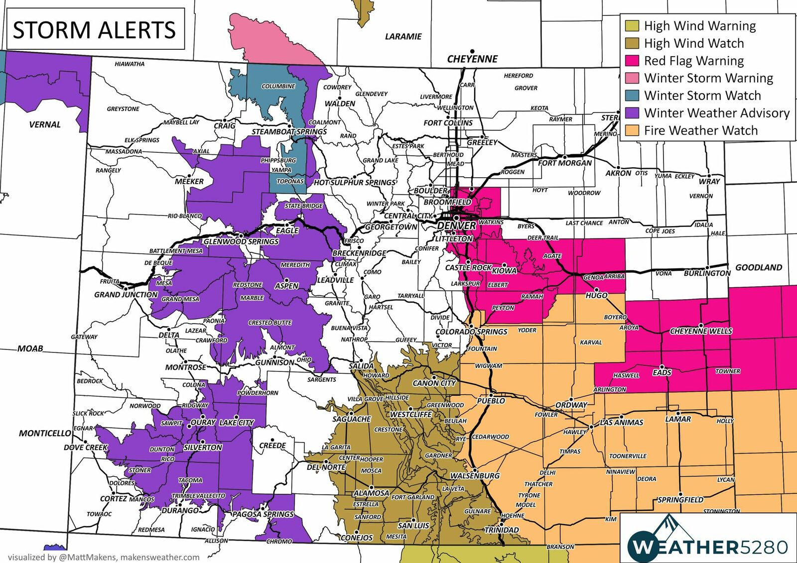
RED FLAG WARNING
* Timing...11 AM to 8 PM MDT Thursday.
* Winds...Southwest 20 to 35 mph with gusts up to 50 mph.
* Relative Humidity...As low as 8 percent.
* Impacts...Conditions will be favorable for rapid fire spread. Avoid outdoor burning and any activities that may produce sparks.
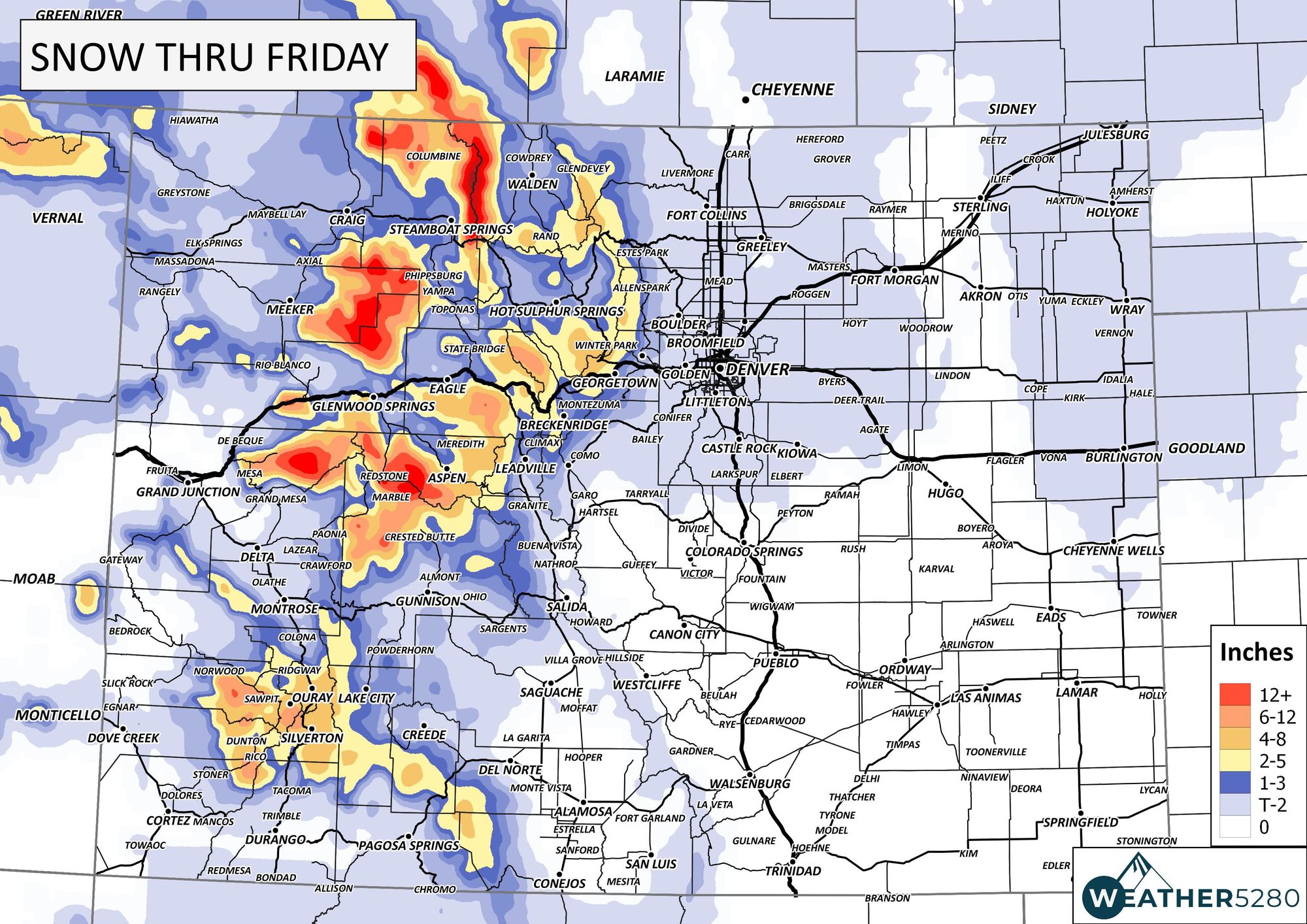
The wind and fire danger is for the Plains, the alerts in place for the high country are for snow, so let's take a look at totals through the end of the week.

Healthy snow will fall yet again in the high country, and we may see some snow mixed in with some rain for the low country to end the week, too.
This is following our Thursday warm-up, so let's look at a timeline to help sort things out.

That planner shows the showers increasing later Thursday through Friday, but again those are lower end chances for the Denver area.
Bottom line: Wind increases overnight through Thursday and will increase temperatures before blowing through a few rain and snow showers. The overall impact on the metro areas is low as compared to the mountains and relative to past events, but we do cool off a touch for Friday. Oh, let's look ahead to the weekend - a nice warm-up right back into the 60s.

As we like to say here at Weather5280, "Don't get left out in the cold," – subscribe to our email list today – we send you an email when there's important information and Colorado forecasts to deliver.


