March 2023 won't end up on any top 20 lists as it ended colder than average (but not historically so) and less snowy than average (but not historically so).
The average temperature in March in Denver ran -5.7°F below the longterm average, with a mean temperature of just 35.9°F. The coldest March on recorded had a mean temperature of just 26.4°F, back in 1912, but to make the top 20 coldest, 2023 would have had to come in at 35.5°F or colder. Oh so close!

Temperature anomalies March, 2023
Snowfall ended up below average as well, but it could have been much, much worse. Officially Denver picked up 5.1" of snow, well below the longterm average of 11.5", but outpacing the record least snowy March on record (Trace, 2012/2017), and well outside the top 20 list which rounds out at 3.2" (1893).
Up north, it was much snowier as we covered multiple boom snowfalls in the Fort Collins area, and we had some great snowfall across the Northeast Plains as well. Here is a look at snowfall totals across the state for March, 2023:

It may come as a surprise to some that April is Denver's second snowiest month on average, especially given this past weekend and the outlook for the next couple of days. The city averages 8.8" of snow in the month of April, with a couple of big-time blizzards in the record book during the month.
So far this April, Denver has managed just 0.2" of snow. While not out of the question that we could still end the month at or above average, this becomes increasingly hard to pull off as we head later in the month for obvious reasons.
Even with this weekend's warmth, the month to date temperature is running -3.2°F below average. IF April were to end below average, this would mark the sixth straight month of below average temperatures for the Mile High City – a remarkable accomplishment in today's world!
- April (to date): -3.2°F
- March -5.7°F
- February: -1.6°F
- January: -6.7°F
- December: -1.9°F
- November: -3.8°F
- October: +2.7°F
That, however, is a big if. We've got quite a bit of warmth to work through in the near term, and even with some chilly air in the forecast by late week, no true true arctic air in the forecast at this time.
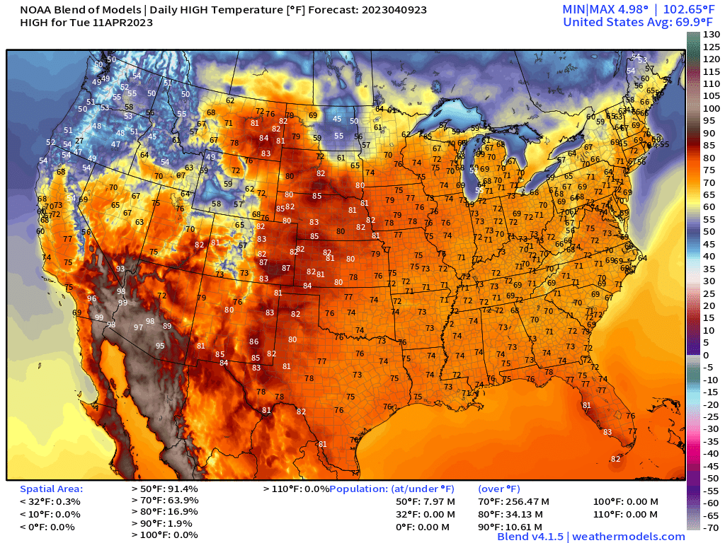
MOS guidance has has in the mid 70s today for Denver and into the low to mid 80s on Tuesday. If we manage to break 80°F on Tuesday, this will set a new record high for April 11th – with the current record being 80°F set in 1972 and again in 1982. Our current forecast has us breaking this record and some Tuesday:

As mentioned above, a system will move through late in the week – Thursday night/Friday, and bring a shot of colder air as well as a chance of rain and snow to much of the state from late week into the weekend.

Most guidance has some snow for the urban corridor by early Friday morning, though with temperatures relatively mild and surface temps coming off a week of very warm weather it's hard to say how impactful the event will be for lower elevations, if at all. Subscribe to our email list so you'll know right away when we publish our snowfall forecasts.
For now, plan on some rain/rain mixed with snow by late Thursday night, and perhaps some accumulating snow by early Friday – especially for higher elevations outside the urban core. We'll keep an eye on snow chances in the city, but for now they remain low – and a far cry from making a dent in our snow deficit as we head into mid April.
Stay tuned and enjoy the warmth!


 Temperature anomalies March, 2023


